Lászlóffy Woldemár Hydrometric Research Station and Experimental Catchment in the Eastern Mecsek
History
The Lászlóffy Woldemár Hydrometric Research Station, operated by the Faculty of Water Sciences of the University of Public Service, is located near Magyaregregy in the Eastern Mecsek Hills, southern Hungary. The station has played a central role in hydrometric education and small-catchment research for more than fifty years.
Field-based hydrometry training within the predecessor institutions of the Faculty began in the late 1960s. After initial exercises in the Bakonynána Experimental Catchment, regular field training started in the Mecsek region in 1968–1969, and from 1970 onwards at the Magyaregregy site, then operated by the South Transdanubian Water Directorate. Despite very modest early infrastructure, the strong emphasis on hands-on education ensured the continuity of the programme.
Infrastructure development in the early 1980s resulted in the construction of a permanent main building. Following Hungary’s political transition, the station and its surrounding land became the property of the Baja-based water engineering education centre, supported by the national water authority.
The station was later named after Woldemár Lászlóffy, a renowned Hungarian hydrologist, upon the initiative of Dr István Zsuffa, who also established the unified field training programme still in use today. Since 1970, nearly all civil engineering graduates trained in Baja, along with many environmental engineering students, have completed hydrometric field exercises at the station. The site has also hosted international training courses, summer schools, and professional programmes involving partner institutions from Hungary and abroad.
Current research
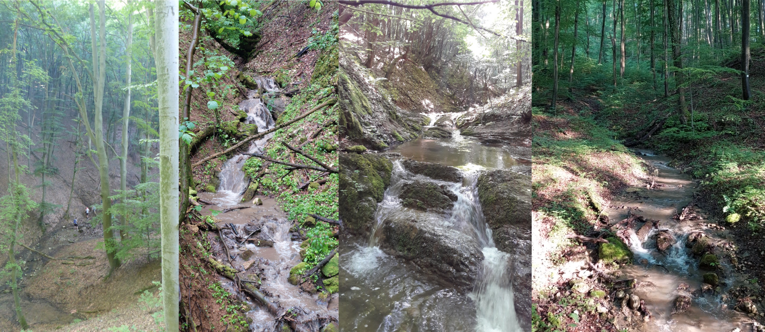
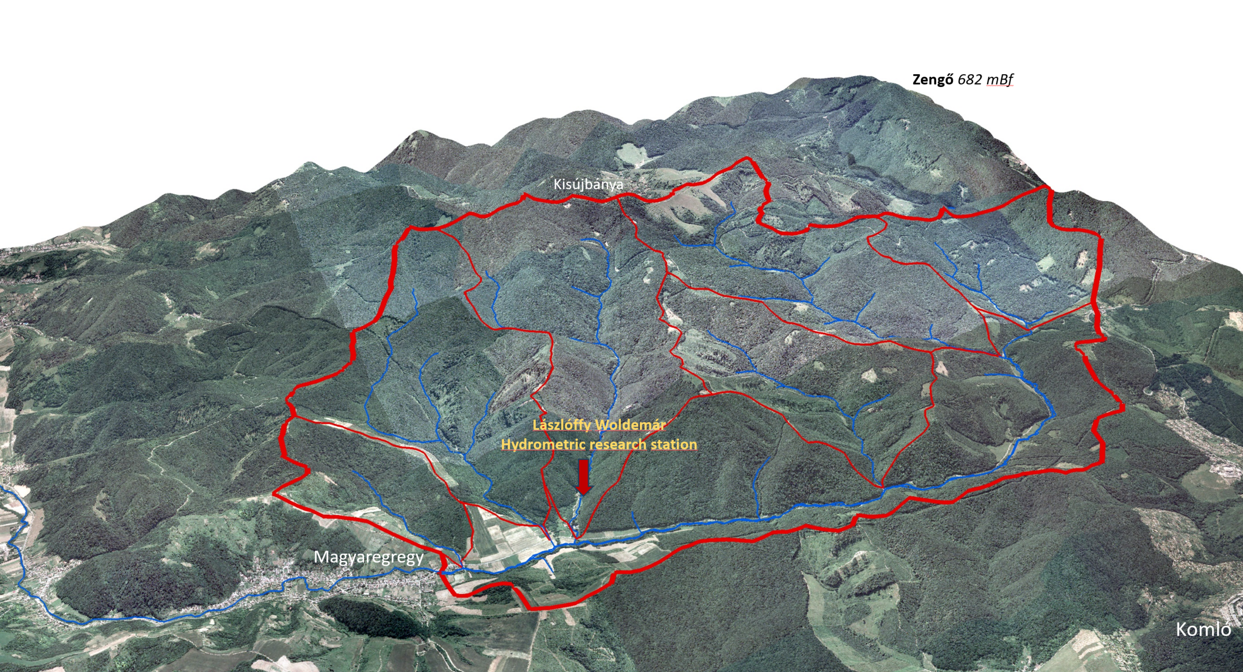
The 32 km² experimental catchment surrounding the station forms the core of the Faculty’s research programme on small hilly catchments. The area is part of a protected landscape, ensuring near-natural conditions, and is drained by the Völgységi Stream, whose outlet is located at Magyaregregy.
Recent hydrological changes related to climate change, including prolonged droughts and increasingly intense rainfall events, have highlighted the limitations of historical datasets and the need for improved process-based modelling. To support reliable modelling and prediction, detailed field observations are essential.
Systematic catchment exploration and monitoring development began in 2018–2019, including flood measurements, infiltration tests, and comprehensive soil surveys conducted in cooperation with the University of Miskolc. A dense soil moisture monitoring network was established in the Vár Valley sub-catchment, which has become a key focus area.
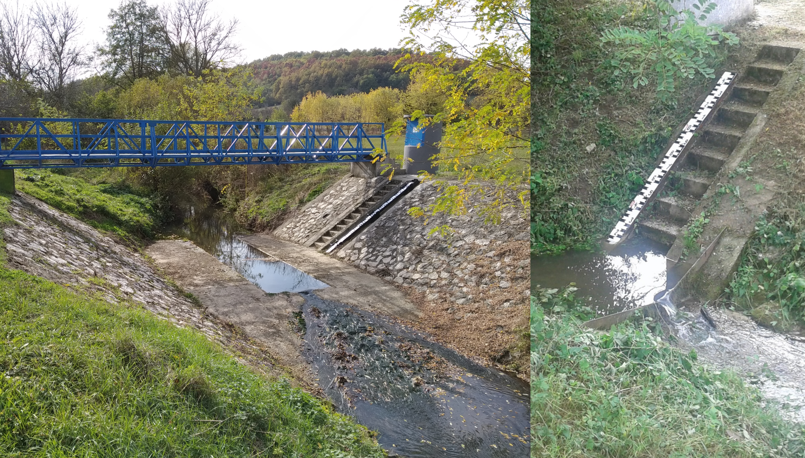
Since 2019, the monitoring system has been continuously expanded with meteorological and hydrological stations, measuring precipitation, soil moisture, wind characteristics, radiation, air temperature, and humidity. Additional instrumentation includes mobile sensors, a drought monitoring station, and a disdrometer for precipitation type classification. Streamflow is currently monitored at four gauging stations, supported by regular calibration measurements.
The experimental catchment serves as an integrated research and education platform, involving BSc, MSc, and PhD students, and contributing directly to model development, water resources management, and flood risk mitigation.